CCY Route in Rocky Mountain National Park

A Trip Report from Eric’s hike on CCY Route in July 2020

**Note–this trail is currently (5/2021) closed due to the impact of the wildfires last fall. For up-to-date information about availability please check here

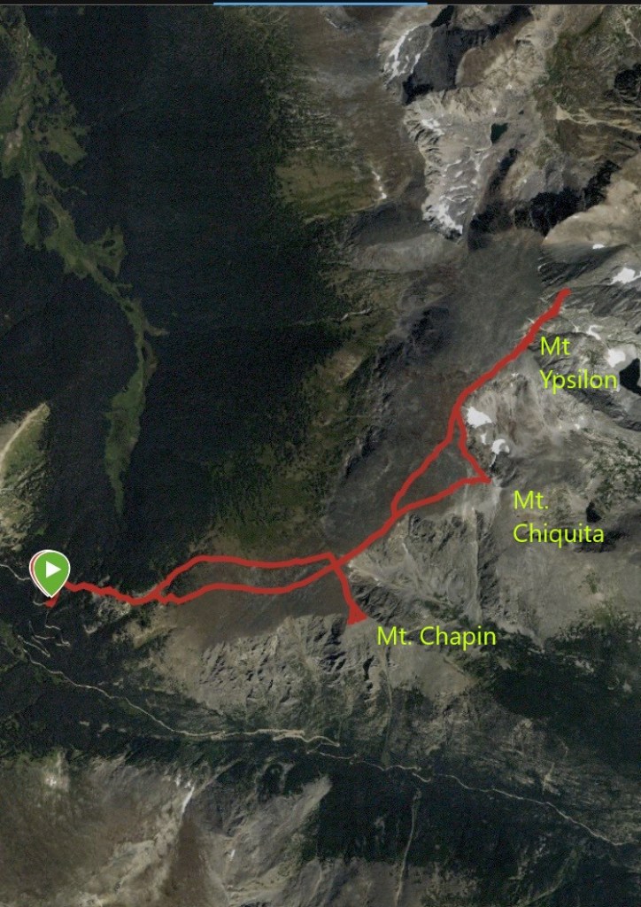
Chapin, Chiquita and Ypsilon summits

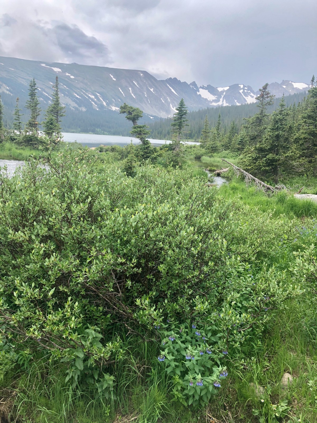
Last month, I got to take an early morning hike on a route that I’d been looking forward to for a long time: the “CCY Route” in Rocky Mountain National Park. The “CCY” stands for Chapin, Chiquita and Ypsilon, three prominent summits in the Mummy range in the north-central section of the park. Easy access to this hike is only available for a few months out of the year due to the trailhead location, which is several miles up Old Fall River Road. Alltrails.com lists the route as 8.9 miles round-trip, with 3,244 feet of total elevation gain. However, it’s important to note that this hike is above the tree-line for the majority of the journey, and much of the terrain is considered to be Class II rock hopping.

CCY Trailhead and Where to Park for CCY Route

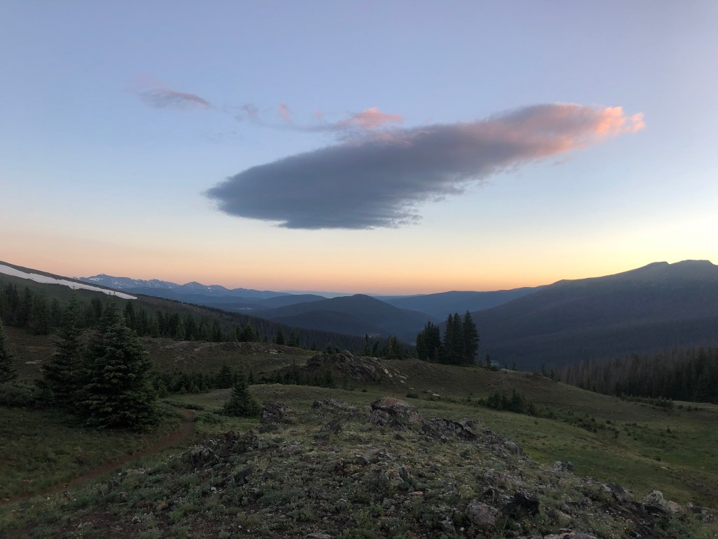
An early start here is important for two reasons. First, as always, any time spent above the tree line in the summer in RMNP is best done earlier in the day before afternoon thunderstorms pop up. But second, this trailhead has very limited parking available along the side of Fall River Road, only enough for maybe 12-15 vehicles. I arrived at 5:25am and was the third car there, so had plenty of space. But as I was making the switchbacks in the dark, I was thinking what my backup hike might be, and Mount Ida crossed my mind—this is another summit on my list that also requires a journey up either Fall River Road or Trail Ridge Road from Estes Park, and it does have substantially more parking at the Continental Divide/Poudre Lake trailhead. But anyway, on to the adventure…

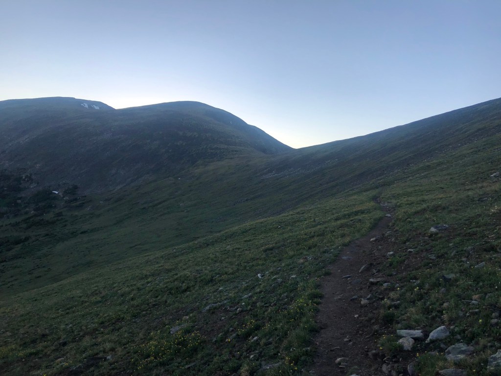
I had a headlamp in my pack, but there was just enough light to proceed without it as I started my hike. Just a few minutes in, you reach a clearly marked junction that directs you to the right for the CCY summits, rather than continuing on the main trail to Chapin Pass.

Chapin, Chiquita, Ypsilon Summits. Chapin creek. Chapin Pass Trailhead

From here the path becomes far steeper, ascending several rock “steps” to break through the trees to the edge of the tundra. At around the .6-mile mark, another trail split appears, and the sign guides to the right for “all summits.”

CCY Summits Rocky Mountain National Park. Things to do in Rocky Mountain National Park.

I’d read that actually either way would work here but decided to follow the sign and continue on the path to Mount Chapin. At this point, the sun was starting to rise, but was hidden from my view, being on the western slopes of these three mountains. Still though, the views looking back were beautiful!

path to Mount Chapin in Rocky Mountain National Park.

The route to Mount Chapin is easy to follow from here, despite a few small “rock crossings” along the way.

CCY trail in Rocky Mountain National Park.

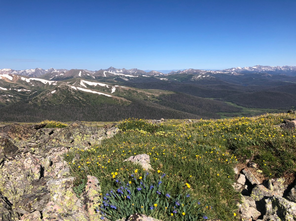
Just past the 1.5 mile mark, a side trial heads straight up to the summit of Mount Chapin, gaining approximately 400 feet of elevation in less than half a mile. The trail is faint in places, so I found myself just trying to stay on the rocks (avoiding stepping on the wildflowers!) and just generally heading up. The views at the top were great!

Summit of Mount Chapin
Looking towards Long’s Peak in the distance
Mount Chapin in Rocky Mountain National Park.
Found the sun!

I didn’t stay long on Chapin’s summit, because the wind was absolutely howling, and I knew that I had two more to go, with plenty of “up and down” along the way. After retracing my way back down to the main trail, I started up the slope of Mount Chiquita.

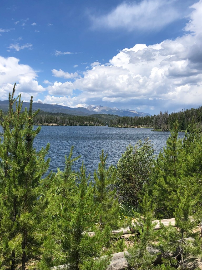
The combination of wind, terrain, and even the bright sun ahead (hard to look up and track the route) made this section of the hike somewhat of a grind, as the route gains over 1,000 feet of elevation over the course of a mile to reach the summit at 13,069 feet. There are a few wind shelters built of rocks around the summit, which can provide a needed reprieve. It was hard to capture great photos shooting right into the sun, but the views were again great, as you could also see several of the lower-elevation lakes below.

Hike CCY Route in Rocky Mountain National Park

From the summit of Chiquita, the trail is faintly marked, so I just followed what I felt was the most efficient route down to the saddle between Chiquita an Ypsilon, losing around 300 feet of elevation. The third and final summit was a bit deceptive. The terrain isn’t too tricky, and you can try to follow the occasional cairns that are placed along the way, but the true summit is hidden from view for a good portion of the ascent, which gains 700+ feet along the way.

Summit of Ypsilon
Some visible snow near the summit of Ypsilon.

I don’t think I carved the best path up the mountain, but eventually made my way to the top at 13,514 feet, where I joined 3 other hikers that had been ahead of me all morning. We all had a nice visit, taking in the views, and enjoying miraculously still conditions given how windy it had been just an hour or so earlier. I took a quick video of the sights:

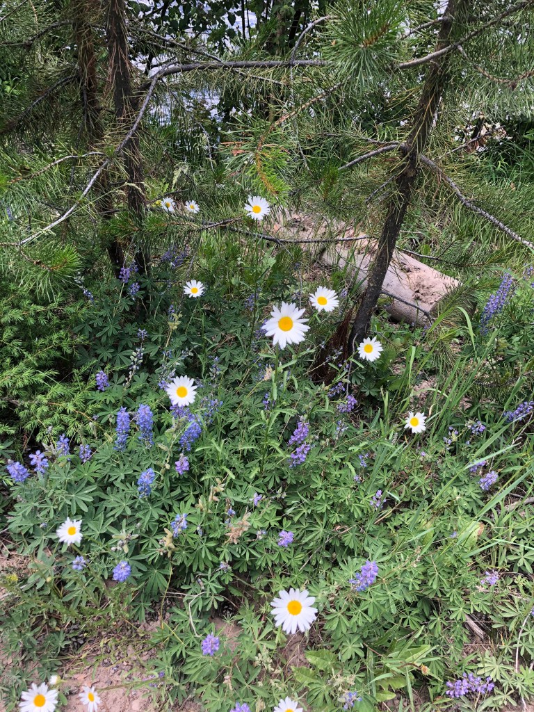
On the way back down, rather than re-summiting Chiquita, I followed a faint path around the edge of the mountain, heading directly towards the saddle between Chiquita and Chapin. The wildflowers were particularly spectacular on this portion of the hike.

wildflowers between Chiquita and Chapin in Rocky Mountain National Park

When I made it back to the saddle, I decided to follow the “other” option back towards the trailhead, which dipped slightly lower along the mountain. It was nice to see this section of trail rather than re-tracing my steps, but I also got to see some elk grazing in the valley below.

Elk grazing in meadow in Rocky Mountain National Park

I made it back to the trailhead with a total time of four hours and 36 minutes, according to my Garmin watch that tracked my adventure. Below is a map of my route, showing the two splits I described (“to all summits” early on, to the right, and then the “Chiquita cutoff” on the way back).

CCY Route in Rocky Mountain National Park. Colorado.

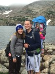
I was trying to make relatively good time, as Kelly had let me slip away for this one by myself, and was back at our cabin with the girls waiting on me to go grab lunch.  It was a great adventure, and a nice challenge. The class two terrain made me wish I would have brought my trekking poles for the decent(s), but other than that, I finished in great spirits and was thrilled to have had the chance to pick up three more RMNP summits all in one day. I’d definitely like to revisit this one again in the future!

Feeling Stuck? Try Going on a Hike

“Nothing diminishes anxiety faster than action.”

Walter Anderson

3-2-1, we are counting down the days until my daughter starts kindergarten next week. We’ve met the teacher and bought school supplies. I’m confident that she is ready to learn and make new friends.

But, am I ready? I’ve been a stay-at-home mom since she was born. Together we have gone on countless adventures to the library, coffee shops, gymnastics, berry picking, and the zoo. Her little sister and I will miss her very much when she is at school every day.

On the other hand, I’m mentally prepared for the possibility that her in-person classes might turn to virtual at any point during the first semester because of the pandemic. I dislike uncertainty, but mostly I’m scared that we might make the wrong decisions.

Finally, I’m thinking about what the future looks like for my career once the girls are both in school full-time. With this much uncertainty, can I even start to think about my own goals?

I was processing all of this on our hike to Bierstadt Lake. As I walked the switchbacks up towards the lake, I realized that COVID-19 has made it harder to do everything and somehow even simple tasks like going to the grocery store felt like too much. I resolved to take that errand back onto my plate and off my husband’s. This little momentum shift has created a snowball effect and I’m starting to feel empowered again.

Perhaps I was able to feel, think, and work through so many big thoughts and emotions because there is plenty of space for me to do that in the mountains.

And now for some pretty pictures and video from our hike!

Bierstadt Lake hike in Rocky Mountain National Park.

Are you feeling anxious about the upcoming school year? You might find some inspiration in these, 22 Calming Quotes for People with Anxiety from Psychology Today.

If you want to go on this awesome hike to Bierstadt Lake, check out our past posts which go into more details about the hike’s distance, elevation change, and other key details. It’s one of our favorite family-friendly hikes in Rocky Mountain National Park.

Family Hike to Bierstadt Lake Plus An Unexpected Moose Sighting

Our Rocky Mountain Tot goes to Bierstadt Lake

Don’t Feed the Ducks!

Favorite 2-4 Mile Hikes

Snowshoe in Rocky Mountain National Park

Long Lake in Brainard Lake Recreation Area

On today’s hike I have the cutest little hiking buddy around. My 3-year-old daughter and I went on a .3-mile stroll to Long Lake which is located on the border of Brainard Lake Recreation Area entering into the Indian Peaks Wilderness.

Where is brainard lake recreation area?

Estes Park to Brainard Lake
From Estes Park, take Highway 7 to Highway 72 and then turn onto Brainard Lake Road. The drive takes about 50 minutes.

Brainard Lake is also 50 minutes from Boulder and an hour and a half from Denver. Nearby towns include Nederland and Ward. It’s convenient location makes this a popular destination. Plan for long lines at the entrance and limited parking at trailheads, especially on weekends and holidays.

BRAINARD LAKE RECREATION AREA Entrance Fee

A day pass to Brainard Lake typically costs $12 per vehicle during the summer season which is July through mid-October. Brainard Lake Recreation Area is managed by the US Forest Service. You can find more information about fees and guidelines here. We use our annual America the Beautiful pass which includes entry into national forest areas as well as national parks.

When we arrived late in the afternoon, no one was stationed at the entrance booth, so visitors were expected to go to a self-pay kiosk.

Indian Peaks Wilderness. Brainard Lakes Recreation Area. Long Lake trailhead. Hiking Colorado.

parking at long lake trailhead

There are thirty parking spaces at Long Lake trailhead. We were lucky to get a parking spot on this trip. On previous occasions, we’ve parked in the larger parking lot near Brainard Lake and hiked up to the trail. Because of COVID-19, the parking is further restricted to 80% capacity. Once the lots are full, no vehicles are allowed into the park until the next scheduled timed entry. The timed entries are at 6:00 am, 10:30 am, Noon, and 1:30 pm. There is additional parking at the Gateway Trailhead which is located outside of the paying station. Walking trails lead into the main park.

Indian Peaks Wilderness. Brainard Lakes Recreation Area. Long Lake trailhead. Hiking Colorado.

high elevation trails

The elevation of Long Lake is 10,521 ft. There is typically snow until July. It’s unbelievably green and there is an abundance of wildflowers. This area is breathtaking!

Indian Peaks Wilderness. Brainard Lakes Recreation Area. Long Lake trailhead. Hiking Colorado.

dog friendly hiking trails

Dogs are allowed at Brainard Lake Recreation Area if they are on leash. We featured this area in our post, Dog Friendly Hikes near Estes Park, Colorado.

Indian Peaks Wilderness. Brainard Lakes Recreation Area. Long Lake trailhead. Hiking Colorado.

Moose in brainard lake recreation area

On our drive out of the park, we spotted moose near Brainard Lake. We were able to capture these pictures from our car. It’s important to give moose a lot of space because they are fast, large, powerful animals.

Moose at Brainard Lake in Colorado

trail maps for hikes in brainard lake recreation area and indian peaks wilderness

The short walk to Long Lake and back was perfect for my daughter. It was fun to see the little boost to her self-confidence from getting my full attention and slowing the hiking pace to her level. She wanted to look at every rock and step on every tree stump. I don’t have the patience to indulge in this level of curiosity on every hike we go on. It was a special treat for us and I’m thankful for the mini-adventure.

If you want to hike further, there are plenty of options. This map shows the trailheads within Brainard Lake Recreation Area. You can access the Jean Lunning Trail and the Pawnee Pass Trail from the Long Lake trailhead. These trails will take you towards Lake Isabelle. Additional hiking information and an Indian Peaks trail map can be found here.

more posts featuring brainard lake recreation area

Add This to Your Hiking Bucket List! Blue Lake in Indian Peaks Wilderness

2 Day Itinerary with Toddlers in Estes Park

Brainard Lakes Colorado, Indian Peaks Wilderness

Wildflowers in Bloom: A Family Hike to Mitchell Lake

East Shore Hike in Rocky Mountain National Park

Today I want to share a scouting report for a new (to us) trailhead in Rocky Mountain National Park. East Shore is located on the west side of the national park near the town of Grand Lake and Granby Colorado. The trail borders Shadow Mountain Lake and Lake Granby as well as the Colorado River. We parked near Shadow Mountain Dam. Our girls found the dam fascinating. (Their excitement could be attributed to the movie Frozen 2 which features a dam breaking as a major plot point.)

East Shore trailhead Rocky Mountain National Park. Hike near Grand Lake and Granby.

From the trailhead you could see Green Ridge Campground which is part of the Arapaho National Recreation Area.

East Shore trailhead Rocky Mountain National Park. Hike near Grand Lake and Granby.
National Park signage at East Shore trailhead.

The East Shore trailhead gives hikers access to RMNP as well as the Continental Divide National Scenic Trail. From Shadow Mountain Dam, we headed north for a half mile. The total distance of the East Shore trail is over 20 miles.

By the time we made it to East Shore, we had already hiked up on the alpine tundra and gone kayaking on Grand Lake. Given all the activities of the day, it’s not surprising that we only made it through a very small portion of the trail. We are excited to return when we have more energy and time to explore.

East Shore trailhead Rocky Mountain National Park. Hike near Grand Lake and Granby. Views of Lake Granby and Shadow Mountain Lake
The East Shore trail features lake and mountain views. Imagine how pretty it would be at sunset.

Trail Positives: Lake views, mountain views, wildflowers, dam.

Trail Negatives: Distance from our cabin in Estes Park.

Final Thoughts: This trail would be a good option for people visiting Grand Lake or Granby, Colorado. Remember that hiking in Rocky Mountain National Park requires a park pass and a timed-entry permit.

East Shore trailhead Rocky Mountain National Park. Hike near Grand Lake and Granby. Views of Lake Granby and Shadow Mountain Lake
The section of the trail was flat and easy for my 5-year-old to walk on.
East Shore trailhead Rocky Mountain National Park. Hike near Grand Lake and Granby. Views of Lake Granby and Shadow Mountain Lake
Wildflowers blooming along East Shore trail in Rocky Mountain National Park.