
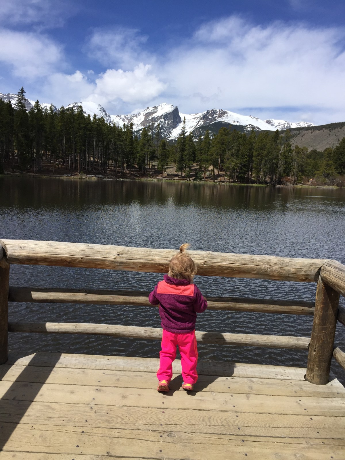
Bear Lake Loop
location: Rocky Mountain National Park (RNMP)
trailhead/parking: Bear Lake has a ranger station, non-flushing toilets and waste receptacles. There is a large parking lot that fills up quickly. Bear Lake is also a shuttle stop on the Bear Lake Route.
distance: .5 mile loop
elevation start: 9,475 ft
elevation gain: 20 ft
level of difficulty: this hike is ideal for all ages and skill levels, but the elevation is enough to take your breathe away if you aren’t acclimated. There are benches placed around the path to enjoy a moments rest and take in the scenery.
landmarks: views of Hallett Peak make the perfect family photo opportunity. Bear Lake trail head is the launching point for many of our favorite longer hikes such as Flattop Mountain and Hallett Peak.
Bear Lake related posts:

Nymph Lake
location: RMNP
trailhead/parking: Bear Lake
distance: .5 miles each way
elevation gain: 225 ft
level of difficulty: my toddler would not make it far on this hike because it starts out with a pretty steep incline so we use a child carrier.
landmarks: known for pond lilies

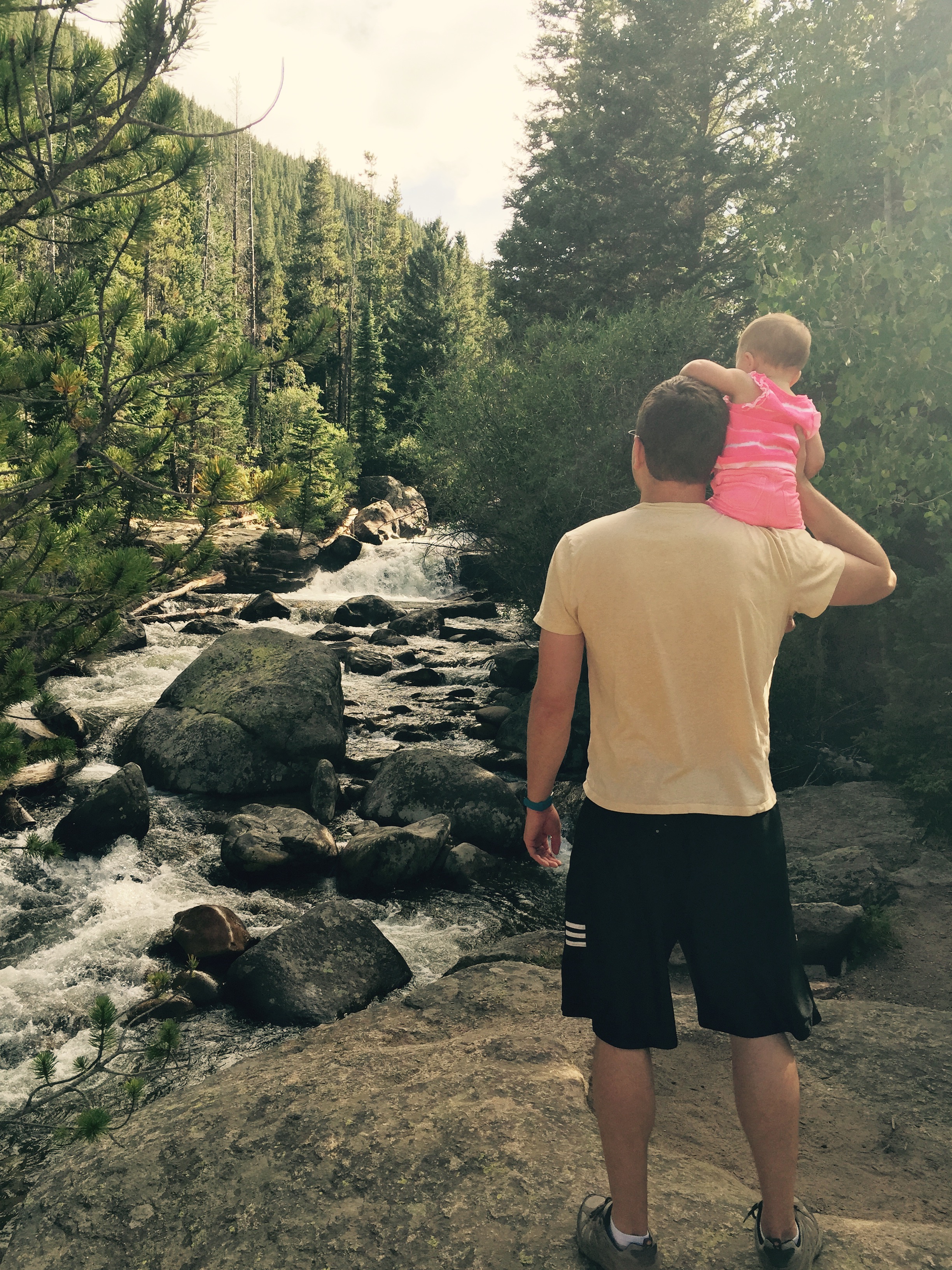
Alberta Falls
location: RMNP
trailhead/parking: Glacier Gorge has a small parking lot and is serviced by the Bear Lake route shuttle, you can also reach the falls via Bear Lake TH.
distance: .8 miles each way
elevation start: 9,180 ft
elevation gain: 160 ft
level of difficulty: We recently made this hike in the snow with our 5-year-old and 3-year-old. Our younger daughter needed help a good portion of the way, but our older daughter was able to hike most of this trail on her own.
landmarks: The impressive falls are beautiful year-round. This is a must see attraction in the park.
Alberta Falls related posts:
Winter Hike to Alberta Falls in Rocky Mountain National Park

Sprague Lake Loop
location: RMNP
trailhead/parking: Sprague Lake has parking, camping spots, picnic tables, non-flushing toilets and waste receptacles.
distance: .5 mile loop
elevation start: 8,690 ft
elevation gain: 20 ft
level of difficulty: This flat hike is ideal for all ages and skill levels. My daughter walked around the trail when she was about one and a half with many detours to climb rocks, look at rocks and sit on benches along the path.
landmarks: great views of continental divide, we’ve spotted a lot of trout

Copeland Falls
location: Rocky Mountain National Park in the Wild Basin Area located approximately 19 miles south of Estes Park on highway 7
trailhead/parking: the Wild Basin area is more remote than other areas of the park. Drive down narrow dirt roads to get to the Wild Basin trail head. There is no shuttle service in this area of the park.
distance: .3 miles each way
elevation start: 8,500 ft
elevation gain: 15 ft
level of difficulty: Great for all ages and skill levels.
landmarks: lower and upper falls
Copeland Falls related posts:
Into the Wild Basin in Rocky Mountain National Park
Family Friendly Waterfall Hike in Rocky Mountain National Park’s Wild Basin
Adams falls
location: East Inlet trail head on the west side of Rocky Mountain National Park.
trailhead/parking: there is a gravel parking lot.
distance: .3 miles/way
elevation start: 8,520 ft
elevation gain: 79 ft
level of difficulty: easy
landmarks: large waterfall with viewing deck
Adams Falls related posts:
Peaceful Hike to East Meadow in Rocky Mountain National Park

Lake Irene
location: off of Trail Ridge Road approximately 5 miles south of the Alpine Visitors Center
trailhead/parking: small parking lot, picnic tables, non-flushing toilets
distance: .8 mile loop
elevation start: 10,471 ft
elevation gain: negligible
level of difficulty: easy, but high elevation
landmarks: alpine mountain lake
Lake Irene related posts:
Serene Family Friendly Walk Around Lake Irene in Rocky Mountain National Park
Lily Lake Loop + Lily Ridge Trail
location: 6 miles south of Estes Park on Highway 7 right across the street from Twin Sisters TH (not to be confused with Lily Mountain which can be accessed about a quarter mile closer to Estes Park)
trailhead/parking: Lily Lake has a small parking area, non-flushing bathrooms and picnic tables.
distance: .8 miles round trip
elevation start: 8,930 ft
elevation gain: 8,940 ft
level of difficulty: The loop trail around the lake is flat with benches available for rest. If you choose to add on the Lily Ridge Trail which takes you up 100 ft in elevation and adds .4 miles to hike, the trail becomes slightly more difficult for smaller children to make on their own. The slight elevation gain is rewarded with wide open views of Twin Sisters, Estes Cone and Longs Peak. Another challenge we’ve come across on this hike in certain weather conditions is very strong, cold winds.
landmarks: Spot baby ducks, fox and wild flowers. Views of Longs Peak and Twin Sisters.
Lily Lake related posts:
Lily Lake Loop on a Snowy Spring Day

