when is rocky mountain national park going to reopen?
We are itching to get out to the serenity of the Rocky Mountains, but it looks like the Rocky Mountain National Park won’t be open for another month (at least). I’ve been reading through the Safer at Home guidelines that the Governor of Colorado put out earlier this week. The Executive Order restricts Colorado citizens to recreational travel that is no more than 10 miles from their places of residence.
Safer at Home orders will continue for 30 days from April 27, 2020 with the possibility of extension. For out-of-state travelers like us, it just not a good time to visit Colorado. You can learn more at www.colorado.com.
#thinkingofRMNP
In the meantime, Rocky Mountain National Park is featuring pictures on instagram that visitors have taken during previous trips. Tag your photos with #thinkingofRMNP for a chance to be featured by RMNP.
our favorite photos
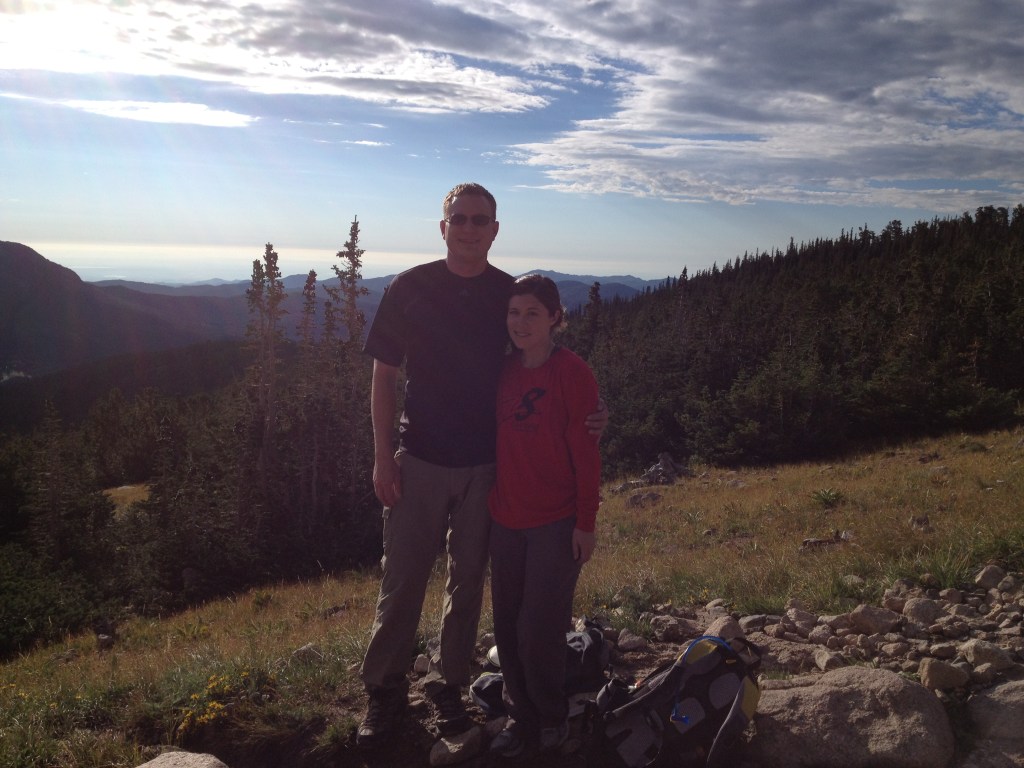
We recently put together a slideshow on our home page with some of our favorite photos from Rocky Mountain National Park and Northwest Arkansas. I’ll also post some of our Colorado highlights right here. I’m not going to lie, going through all these photos and remembering the happy (normal) times, makes me a bit teary. Uncertainty is tough, but it’s comforting to know that the mountains aren’t going anywhere. I hope you all stay safe and healthy wherever home is to you!
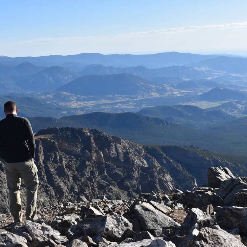
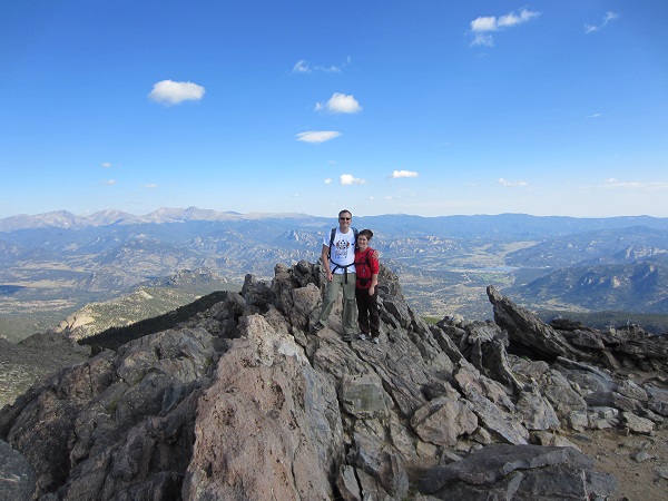
9,500 people per year climb to Longs Peak. I am not one of them.
At 14,259 feet in elevation, Longs Peak is the highest summit in Rocky Mountain National Park. Years ago (7 to be exact), my husband and I took a trip out to Colorado with some of our best friends. We went on several amazing hikes during our vacation. The grand finale was our hike to the Keyhole. I wanted to see what the guys had been bragging about when they talked at length about their epic adventure up Longs Peak.
I started out in a cranky mood. I don’t like waking up early.
There are several routes of varying difficulties that lead to Longs Peak. The Keyhole is the most popular. The National Park Service recommends to start before 3 am in the morning. You will see a lot of head lamps heading up the mountain when you start that early. The average time to complete the summit and return trip is 10-15 hours. You have to start early so that you miss afternoon thunderstorms. (Longs Peak via keyhole route)
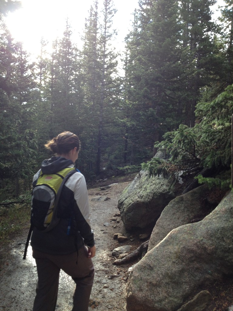
It’s only an adventure if you travel through a Goblin Forest… that’s what I always say.My life-long adventure buddy
Since we weren’t going to the summit, we had a little more flexibility with our start time, but we still had to start early because we would be above tree-line and more vulnerable to lightening for a large portion of our hiking day. The hike to the Keyhole is approximately 12 miles round trip. (add 1.5 miles/way to Longs Peak)
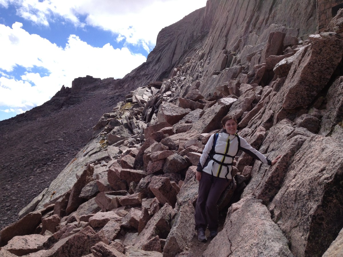
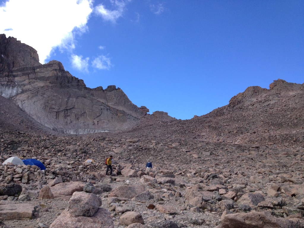
Boulder field
Once you arrive at the Boulder Field, the Keyhole is in sight. At this elevation, each step was slow. It took a lot of energy to keep moving and we had to be careful to choose our steps wisely to avoid turning an ankle.
Stepping over rocks soon turned into more of a scramble up them.
Scramble to Keyhole
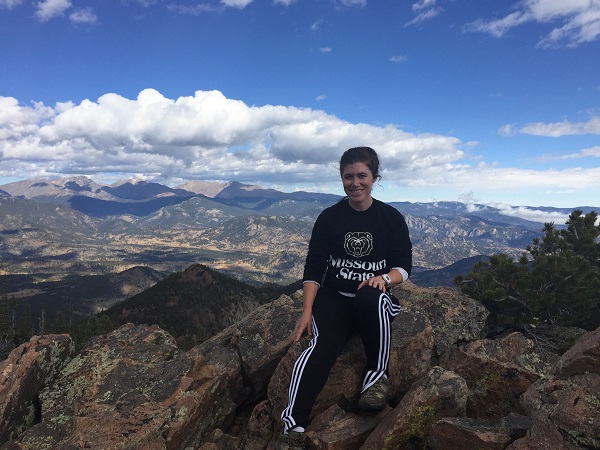
Finally, I climbed up the Keyhole and looked out over the vast views on the other side. It was beautiful! I could see the trail continuing on my left side. There were large bullet marks painted on rocks to help people stay on the trail. If you are politely wondering why I didn’t just go the extra 1.5 miles to the summit, the answer is I’m scared of the exposure. I have a lot of respect for everyone who ventures on after seeing the drop off. I was ready to turn back.
I’m writing about this hike 7 years later because I woke up this morning facing another day of being stuck at home because of the coronavirus. Living through this fear and uncertainty is something I never imagined. I started thinking of the tough things I’ve done in my life:
-The first few weeks of track practice in high school
-Running a half marathon
-Biking 150 miles for the MS 150
-Child birth
-Climbing to the Keyhole
I may be smiling, but this picture captured my relief from getting down from the Keyhole.
My list isn’t all that impressive or unique, but it helps me remember that I can do this. I can reflect back on when I purposely pushed myself to do more than I thought was possible. I think the ‘Keyhole lesson’ for me is trying to take one moment at a time, using the legitimate fear I’m feeling to take appropriate caution, relying on family and friends for pep talks (the people who still love me when I get cranky), and remembering to appreciate the beautiful moments too.
*I found information about the Keyhole route on the National Park Service’s website.
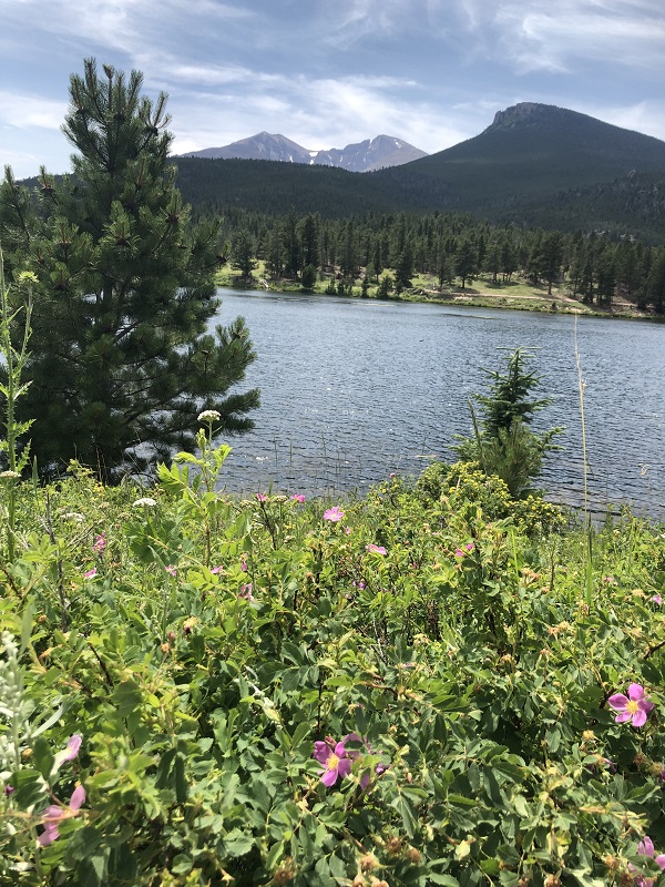
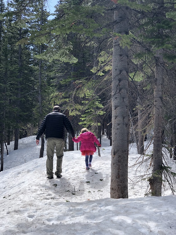
I’m working on a list of our favorite winter hikes in Rocky Mountain National Park. Looking back through the pictures, I realized that the seasons in the mountains don’t go along with our calendar. One of the most enjoyable hikes we took last year was around Bear Lake on June 1st.
The loop around Bear Lake is one of our favorite hikes under 2 miles. Our preschoolers can usually walk the half mile on their own.
This popular spot offers views of Hallett Peak.
We had to hold on to little hands because of the slippery ice and snow on this trip.
The air temperature was chilly, but not freezing. The girls happily played in the snow. We were able to capture some of the happy moments.
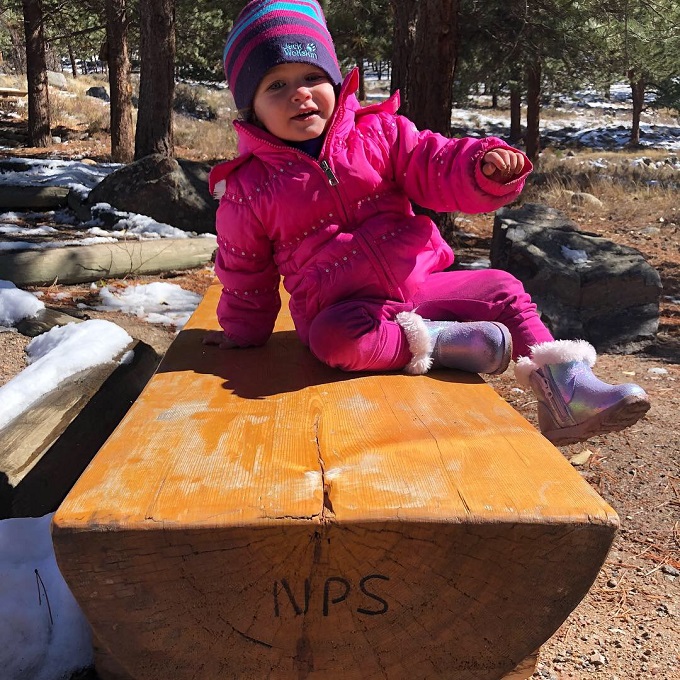
We found a bench that was clear of snow to rest on and take silly photos.
The icy lake was melting in the sunshine. But, there were still sections along the trail where the snow had piled up high enough that it was challenging to see if we were walking on the trail or not. We had to be careful not to step into the freezing lake on accident.
Bear Lake sits at 9,475 ft of elevation. We took a hike the same weekend in Beaver Meadows where the snow had already melted out. It’s amazing how vastly different the conditions can be at higher altitudes.
The conditions also vary significantly year-to-year. At the end of May in 2018, we took a hike from the Bear Lake trailhead and made it further up the mountain to Dream Lake before we encountered a little patch of snow.
If you love the snow, stay tuned for our upcoming post about our favorite snowy hikes in Rocky Mountain National Park.
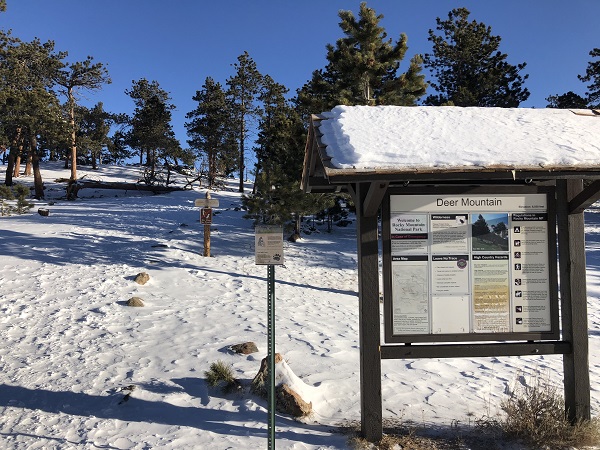
The hike up Deer Mountain is 6.2 miles round-trip and gains just over 1,200 feet of elevation.
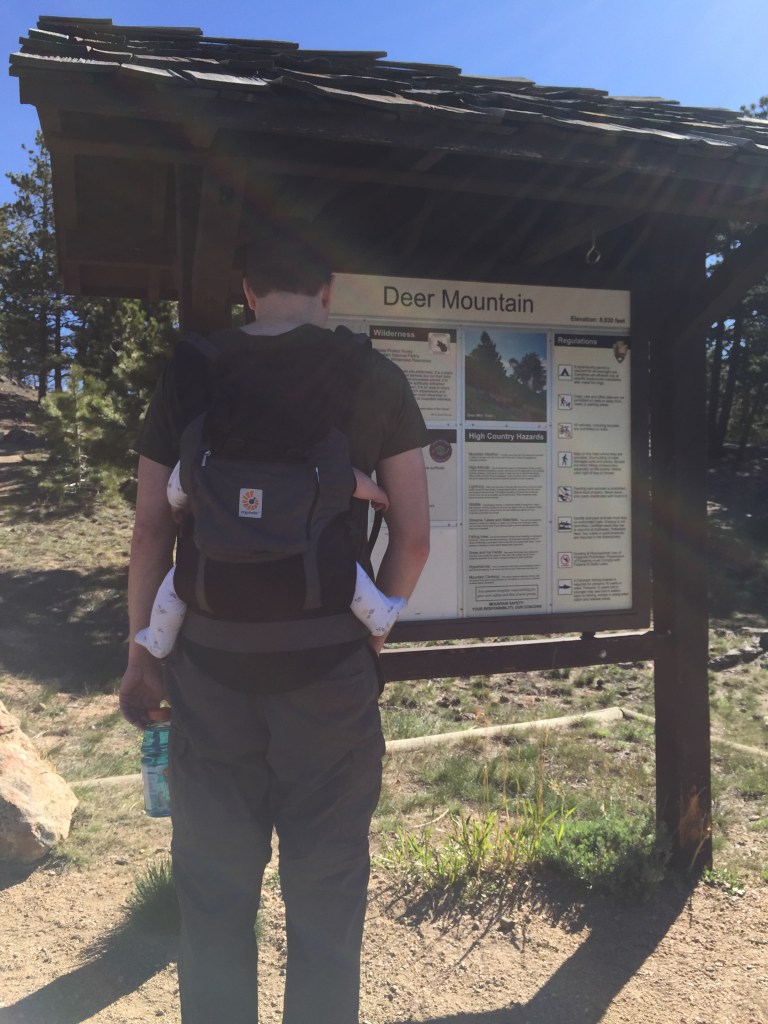
Deer Mountain is a special place for our family—it’s the first hike in Rocky Mountain National Park that we brought our daughter Cecy along with us on back in May of 2015 when she was just six months old. It’s since been known in our family as “Cecy’s Mountain,” reinforced by the fact that you can catch great views of it from one of our favorite places for breakfast/hot chocolate, the Trailhead Restaurant.
Deer Mountain trailhead with our daughter Cecy in 2015
Along with having great views and being one of the more moderate summit hikes in the park, Deer Mountain is also one of the best year-round options due to it’s proximity to the park entrance (less icy roads to contend with) and the fact that the snow tends to blow off/melt out earlier here than in some of the other popular trailhead areas, such as Bear Lake and Glacier Gorge. It’s roughly 6.2 miles round-trip and gains just over 1,200 feet of elevation.
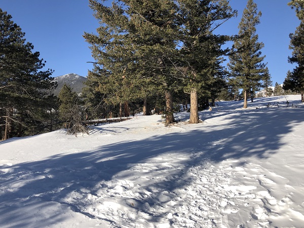
On our most recent trip to Estes Park in late December of 2019, both of our girls came down with a bit of a cold, so we were hesitant to spend quite as much time outside in the chilly air as we typically would with them. We instead focused on taking in the scenery, looking for wildlife, and undertaking an adventure in finding the best chili in Estes Park. But it’s just about impossible for me to be in the mountains and not get out for at least one hike, so after a few days, Kelly was gracious enough to let me slip away for a few hours to try to tackle a familiar hike, but with a new twist—Deer Mountain in Winter/Snow conditions.
The park had a small base amount snow on the ground when we had arrived earlier in the week and had just received and extra 4-8 inches of snow two days before my attempt, so I didn’t know what to expect. Sometimes the popularity of Rocky Mountain National Park can be overwhelming, but in this instance, I was thankful that more die-hard hikers had already been out the day prior to help pack down the trail. I arrived at the trailhead around 9:00am to beautiful sunshine and remarkably calm winds, which made the 14 degree temperature seem tolerable.
It’s been my experience in prior years that for many hikes, traction devices such as yak tracks and a set of trekking poles are more efficient than dealing with snow shoes (unless you are going higher in elevation or deeper in the wooded areas to low-traffic trails), and I was glad to find that the conditions again matched the gear I had brought with me for my hike. I downloaded the GPS map of the area with the AllTrails app as a back-up to make sure I kept on the right path. This came in handy even in the first quarter mile of trail, as the trailhead area had seen a fair amount of aimless footprint tracks from people just pulling off for a quick walk to explore the area, making it a little tricky to discern the main path.
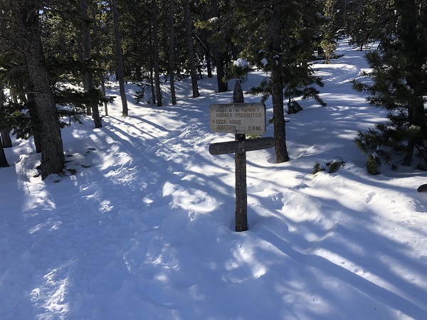
That quickly changed, however, as even though I was the first person at the trailhead that morning, an easy to follow, packed trail emerged for the remainder of my adventure.
One of the memories that always sticks in my mind about Deer Mountain is the long stretch of flat ground, and even a small descent, in the final mile of the hike before the summit push. The snow was quite a bit deeper in this area, and if I accidentally wandered off the trail just a bit, it was easy to post-hole into the soft powder that was just off the main path. Here I spotted tracks from several animals that had also been out playing in the snow.
The final stretch to the summit was substantially steeper, and the trekking poles became a bit more of a necessity for balance in the snow, but it felt quite safe and made for a fun push to the top.
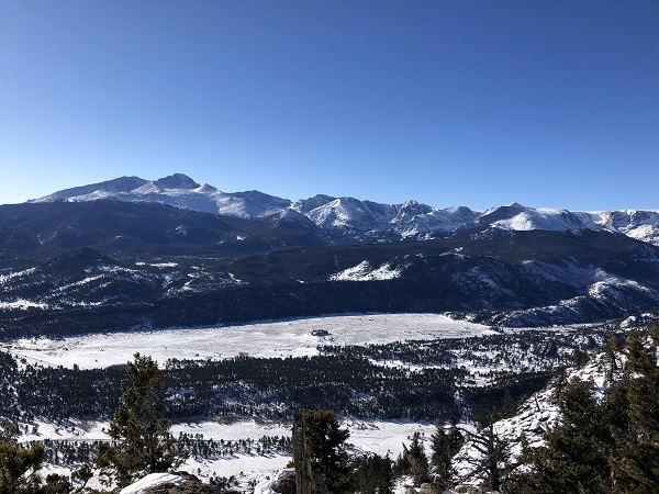
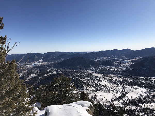
The summit views were beautiful as always. I try to bring an apple or some sort of snack to eat at the destination of any hike, so I slow down for a minute and just soak it all in rather than simply turning around to complete the return journey. Even though the temperature was well below freezing, the hike up the mountain left me quite warm…but that heat quickly dissipated as I had my snack and wandered around to take some pictures from the top.
So without too much time wasted, I bundled back up and started down the trail again. Though I had been alone for the entire hike up and perhaps the first mile and half on the way back down, I did encounter several pairs of hikers on my return journey. Most asked about the trail conditions and were as delighted as I was to learn that the path was well-packed and easy to track all the way to the summit.
I got back to my car at around 11:30 am, satisfied with having completed my first “winter summit” and ready to pick up some chili on the way home. We recommend Deer Mountain as an early summer hike, or really an “anytime” hike in the peak season, but now can feel confident suggesting to friends who want to take on a “safer” winter challenge as well.