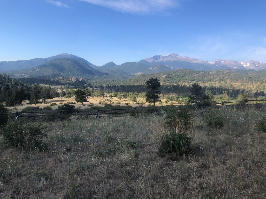
This hike is ‘in the middle of nowhere’ according to my 5-year-old. In reality, Black Canyon trailhead is in the Lumpy Ridge area of Rocky Mountain National Park. The drive is less than 10 minutes from downtown Estes Park, Colorado.
Here is a map of the Lumpy Ridge trails. Lumpy Ridge trailhead begins at 7,840 ft of elevation, I believe that’s the lowest trailhead elevation in Rocky Mountain National Park.
Twin Owls
I agree with my daughter that it feels remote here. That is probably because we didn’t see many other hikers on the trail.
If I were going to buy land someday, my dream would be for it to have a similar landscape. I find the wide-open views and rugged rock formations uniquely inspiring. Drinking coffee and looking out at this view every morning… that’s worth dreaming about. Right!?
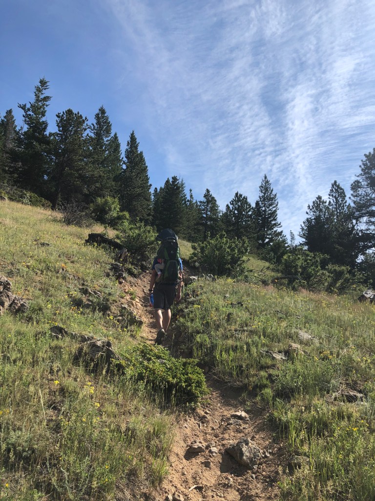
According to AllTrails.com, this hike is 15.5 miles out and back. The trail will take you all the way to Lawn Lake.
Fifteen miles is obviously longer than we would expect to hike with young kids, so we set out with the expectation to turn around when everyone was feeling tired. The girls both did great. At 3.7 miles roundtrip, we hiked substantially farther than our first hike here. We are making progress!
We spotted wild turkeys in the grass. Farther down the trail we saw a coyote or fox (we should have brought binoculars). Lucky for the turkeys, I don’t think their paths crossed.
Between spotting animals, climbing on rocks and trees, and taking in the mountain scenery, I could not have asked for a better morning in Rocky Mountain National Park. I’m thankful for time spent ‘in the middle of nowhere’ with my favorite people.
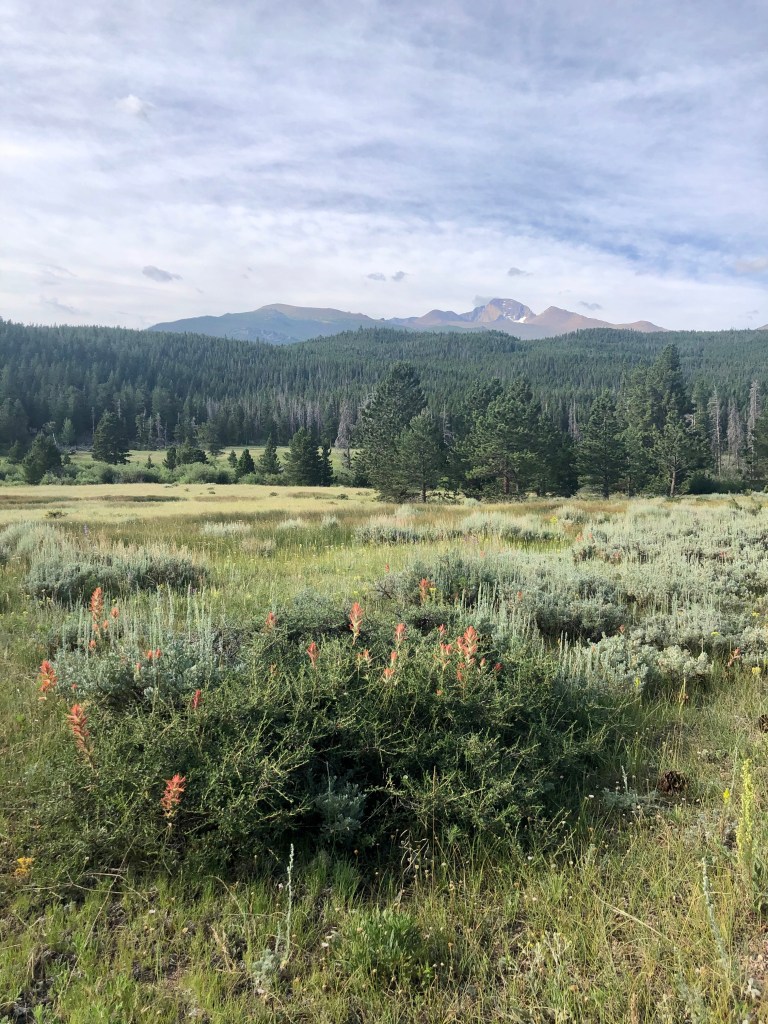
Don’t you love a great backup plan? Our original plan for the day was to hike to Dream Lake, but when we arrived at the Bear Lake parking lot at 7:45 am it was already full. We started driving back down the mountain and found that Glacier Gorge parking was also full and so was Bierdstand Lake. We pulled into the Hollowell Park area hoping we could find a spot. We were relieved to find several parking spaces available.
On a previous trip, we hiked to the Mill Creek Basin and turned around to return the way we came. On this occation, we hiked a loop around Mill Creek Basin and then connected back up with the trail to return to the Hollowell Park trailhead.
Photo of National Park Service map taken at trailhead. I highlighted over to show our route.Longs Peak views
Hike to Mill Creek Basin
The first section of the trail takes you through an open valley with views of Longs Peak. This could be a hot section of the trail during summer afternoons, but soon the path wraps around into a wooded area and follows along side Mill Creek.
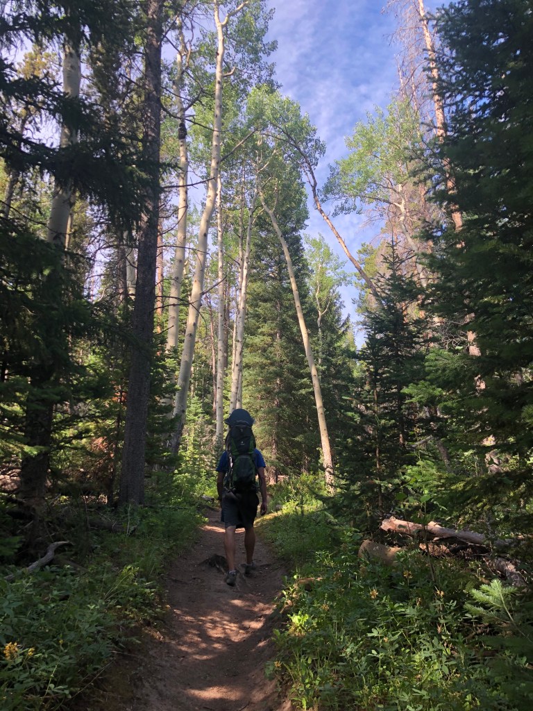
We enjoyed the solitude this hike offered. Over the course of four miles, we passed less than a dozen fellow hikers.
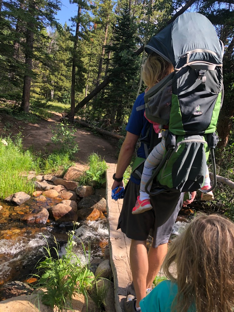
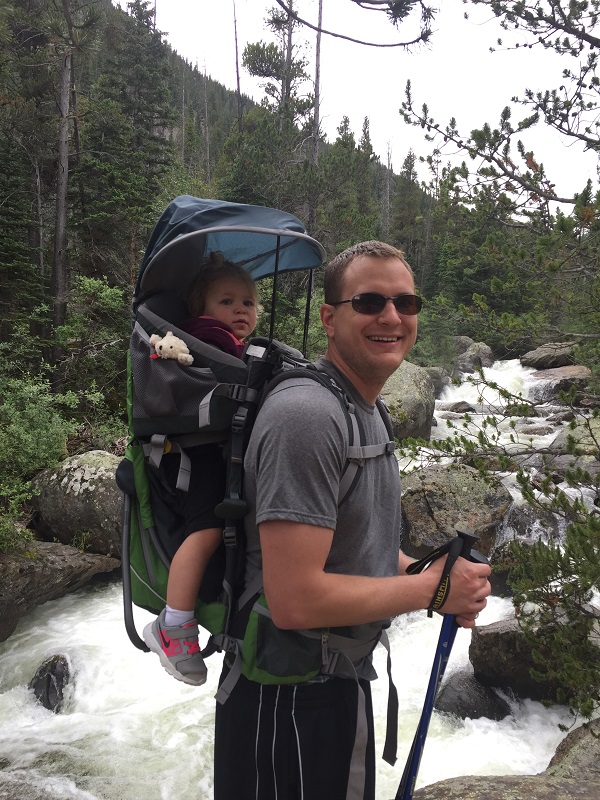
Besides some minor complaints during a couple of the uphill sections on the trail, our 5-year-old walked the trail on her own with a great attitude. Our 3-year-old rode in her kid carrier.
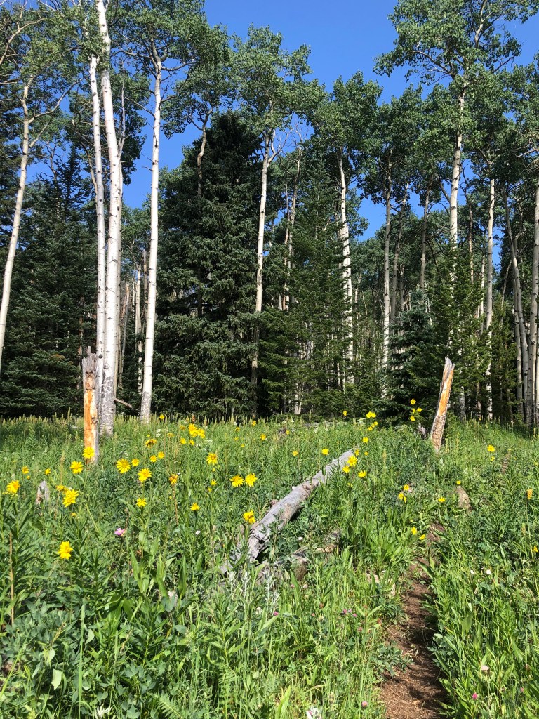
A variety of wildflowers bloomed near Mill Creek and in the open fields.
Wilderness Camping at Mill Creek Basin
Half way through the hike (or 2 miles from the trailhead) we crossed into the Mill Creek Basin. There are two wilderness camping spots available in the Mill Creek Basin. The National Park Service offers a map of all the wilderness campsites in the Bear Lake area including Mill Creek Basin. Additional information about permits and regulations can be found on the national park service’s website.
Mill Creeek BasinUphill section with narrow trailMountain viewsThis section of the trail was steep going downhill (if following the direction we came).
If you are looking for a backup plan hike, a hike that’s less crowded, or a hike with gorgeous wildflowers, I highly recommend giving this loop around Mill Creek Basin a shot. Let me know if you do and what you think!
Want a bigger challenge? This trail connects to several popular destinations in the park including Cub Lake, Bear Lake, and Bierstadt Lake.
Trekking poles – I wish we would have brought trekking poles for the steep downhill section of this trail through the elm trees. I typically don’t have knee issues, but sometimes hiking downhill is hard on my joints and I think the poles help absorb the extra pressure. Trekking poles also come in handy if there are any snowy patches along the trail.
I can’t believe that next week we will be celebrating 4th of July! If you are heading to Estes Park, Colorado, I looked back through our ‘archives’ to see what we’ve done on this holiday weekend over the past several years.
From firework displays to waterfall hikes, we’ve always had a blast. A lot of people complain about the crowds this time of year, but the key is just getting up early. We aim to get into the park before 7:00am. I also have a few suggestions for trails that are typically less crowded.
FIREWORKS HIKE
We took an evening hike starting at the Lumpy Ridge trail head up to a spot that looks over Lake Estes to watch Estes Park’s annual fireworks show at 9:30pm. After the spectacular display, we hiked back down the trail with a large group of people who had the same idea. It was magical to see the trail lit up by headlamps. My preschooler thought it was the coolest thing because she got to stay up WAY past her bedtime. It was one of the most memorable 4th of July’s we’ve had (ever).
Hike in the Wild basin
The Wild Basin area of Rocky Mountain National Park is located approximately 19 miles south of Estes Park on highway 7. The Wild Basin area is more remote than other areas of the park. There is not shuttle service to this area. Even though it is more remote, you will still need to arrive early to find a parking spot, but we’ve been lucky to find spots there even on 4th of July weekend several times.
Once you turn off the highway, drive down narrow dirt roads to get to the Wild Basin trail head. You can walk to Copeland Falls (.3 miles/way) and Calypso Cascades (1.8 miles/way) which are some of our favorite family-friendly waterfall hikes.
The Pool is another hike we’ve enjoyed over the 4th of July weekend. This trail is located in the Moraine Valley area of RMNP. I love that you can shorten the hike by stopping at Arch Rocks or extend it by going on to Fern Falls. I wrote more details in this post.
Alluvial Fan
The Alluvial Fan is a “waterfall” (created by the lawn lake flood in 1982) located right off Old Fall River Road near Horseshoe Park in Rocky Mountain National Park. This is a fun spot to explore. I recommend packing a picnic because there are several picnic spots nearby.
Lake Estes
A walking trail goes around Lake Estes and leads to downtown Estes Park. There is a playground, picnic spots, fishing, and boat rental. You can learn more about the fees, hours, and rentals on their website.
Trail Ridge Road & Grand Lake, Colorado
As I write this post (June 26, 2019) Trail Ridge road is closed because of a late-season snow storm. The scenic highway that connects the East and West sides of Rocky Mountain National Park is typically open this time of year and will hopefully re-open in time for the holiday. Visitors can call 970 586-1222 to get updated information.
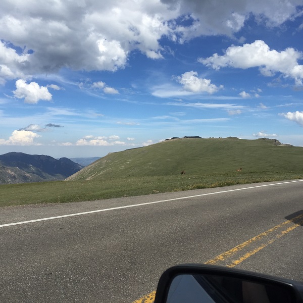
You can spend a full day on Trail Ridge Road if you stop at the many outlooks to take pictures and spot wildlife. The Alpine Visitors Center is awesome for lunch, bathroom breaks, shopping, and breathtaking views!
We enjoy going all the way over to Grand Lake, Colorado to walk along the shore of the largest natural lake in Colorado, play on the playground, and eat ice cream while strolling around the scenic mountain town. I wrote more about Grand Lake here.
Additional POSTS to HELP Plan Your 4th of July Trip to Rocky Mountain National Park