
This month we drove to the Wild Basin area of Rocky Mountain National Park which is 19 miles south of Estes Park, CO on highway 7. The roads are a little bumpy and narrow as they wind back to the Finch Lake Trailhead where we began our adventure.
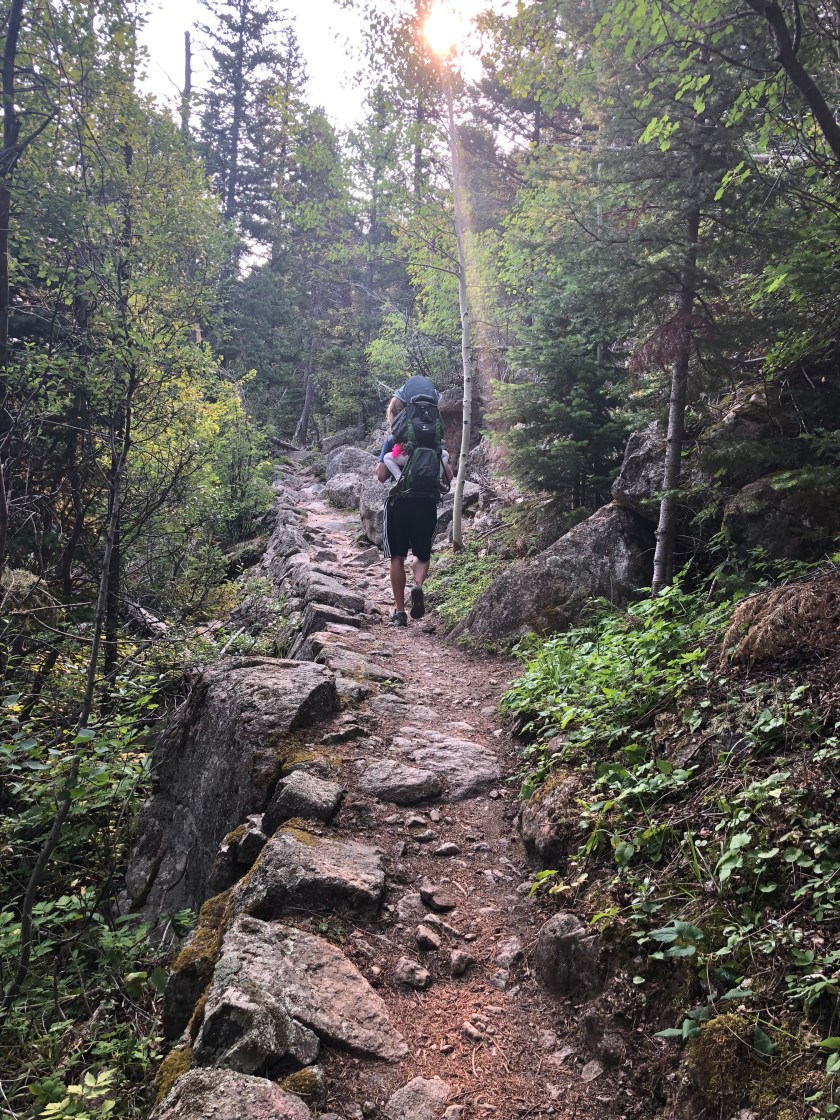
The Finch Lake Trailhead was new to us, so our goal was to hike 2 miles in to explore where it would lead. At first, we regretted our decision because for nearly a mile we hiked straight up hill.
Eventually we turned sharply right and into a dense grove of aspens. The trail flattened out enough for us to catch our breath. We spotted signage that showed a route to the Allenspark Trailhead, but we continued on the main trail towards Finch Lake.

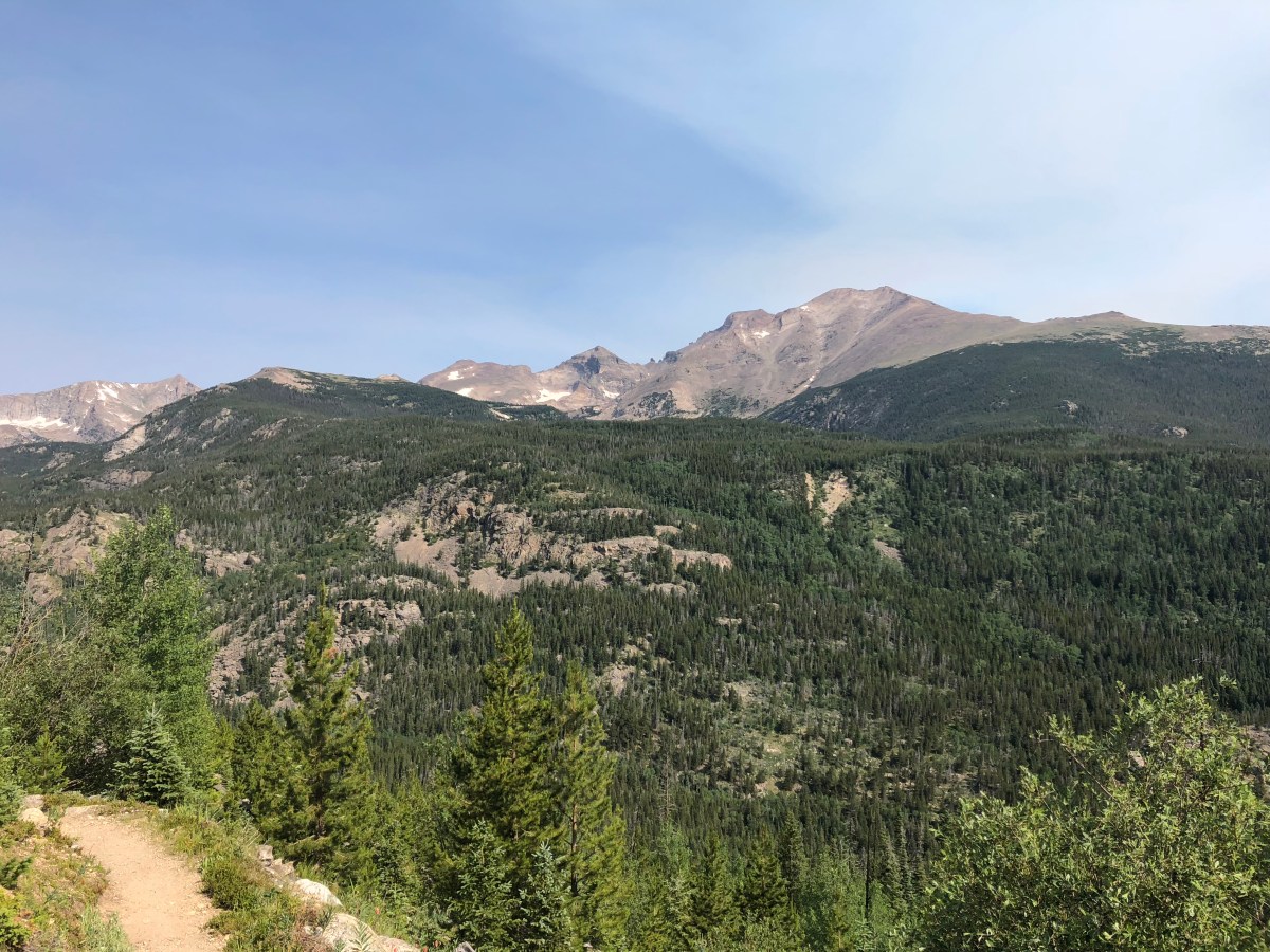
We decided to keep going…at almost 2.5 miles we stopped at a clearing with views of the surrounding mountains. We could see the Wild Basin Ranger Station below which helped us get our bearings and encouraged us to continue despite another steep uphill climb for .3-.4 miles.

We came to another trail sign that showed the ranger station via Calypso Cascades was 3.1 miles away. We turned towards that route knowing the extra 2.2 miles up to Finch Lake would be longer and more uphill.

We were amazed by the stunning views of Mount Meeker, Longs Peak, Mount Pagoda and Chiefs Head. We met a fellow hiker on the trail who told us about a national park fire that scorched the area in 1978. The fire opened up the view and increased the aspen growth.

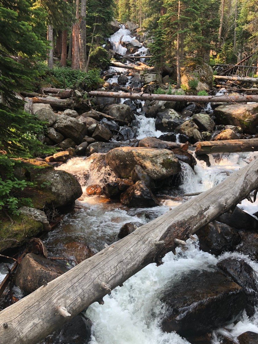
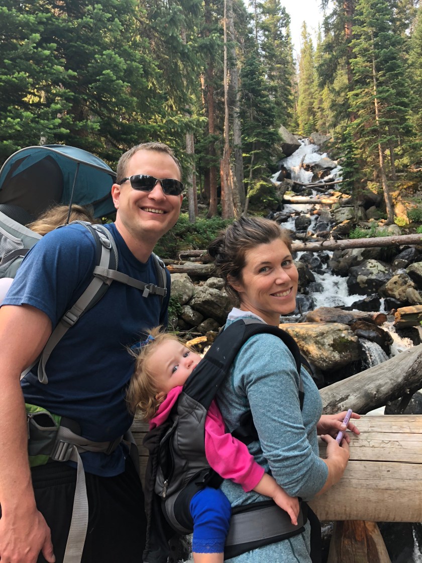
We enjoyed a variety of wild flowers as well as the downhill path that lead us by some of our favorite spots including Calypso Cascades and Copeland Falls.
When we arrived at the Wild Basin Trailhead we walked less than a half mile back to our car at the Finch Lake Trailhead.

We ended up loving this hike! We did it with our 3.5-year-old and 1.5-year-old in carriers which was a bit of a (good) challenge for us.
Wild Basin is awesome! Here are 5 more posts we’ve written about hiking in this area:
Family Friendly Waterfall Hike in Wild Basin
Waterfalls, Wildflowers, Weather and Wine – Why I love Rocky Mountain National Park in July

We found a good spot less than a mile from the trailhead. You are correct – we traveled counterclockwise (towards Gem Lake). The trail is fairly steep, but it isn’t far.
LikeLike
Hello! In one of your posts you mention hiking a portion of lumpy ridge trail to watch the fireworks over lake Estes. Wondering how far you traveled on this trail until you found a good spot? I’m assuming you went counter clockwise from the trailhead? My family (teens and older) are not experienced hikers and I’m trying to determine if this is still a feasible idea. I appreciate any input you may have.
LikeLike
Great rreading your blog
LikeLike