Earlier this month we took a winter trip to Estes Park and Rocky Mountain National Park. Little did we know, a few weeks later the national parks would be affected by the current government shutdown. Unfortunately, that means visitors can’t drive into the park. Based on articles I’ve read, this hasn’t had a big impact on the local economy yet because winter is typically a slower season. With that said, I hope that the situation is resolved soon!
Moraine Park
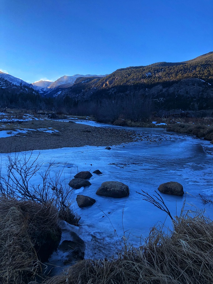
During our December trip, we enjoyed a brief but beautiful hike in Moraine Park beginning at the Cub Lake trail head. We chose this area because at 8,080 ft of elevation there is substantially less snow compared to areas of the park with higher altitude.
I was excited when this picture was featured on the instagram feed @visitestespark where over 930 people liked it.
The first stretch of the hike is in a valley where there is little protection from blasts of freezing wind, but the scenery is worth bundling up and getting out of your cozy cabin for. The Big Thompson River was mostly frozen and seem to glimmer against the blue sky and snow covered mountain backdrop.
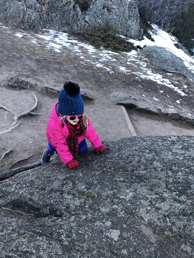
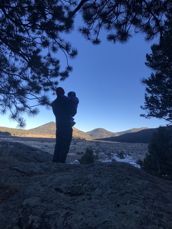
Luckily, you don’t have to walk far before tall trees and surrounding rock formations block the wind. Our four-year-old daughter veered off the path to scramble up boulders to join her sister and dad taking in the peaceful views.
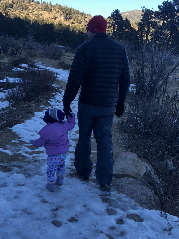
Our nearly two-year-old insisted on hiking in her pajamas, wearing socks as gloves, and borrowing my hat. She held on to my husband’s hand in icy patches, but wanted to show off her independence by walking at her own pace. This led to our decision to cut the hike short. The trail to Cub Lake is 2.5 miles each way. We wrote about this hike in more detail in a previous post, Rocky Mountain Tot Goes to Cub Lake.
New Year Goals
As we look forward to a New Year and new outdoor adventures, our goal is to have the girls walking rather than riding in kid-carriers during many of our hikes. We are excited to discover new hikes in the Rocky Mountains and the Ozark Mountains which are located near our new home in Fayetteville, Arkansas. We will write about all of them in our family hiking journal and also look forward to sharing with y’all too!
I discovered gold! Okay, so maybe that’s an exaggeration, but on our last trip to Estes Park, Colorado I found a new hiking trail located a few minutes from the Safeway grocery store. I squeezed in a little ‘me time’ and got back with the milk before our girls noticed I was gone.
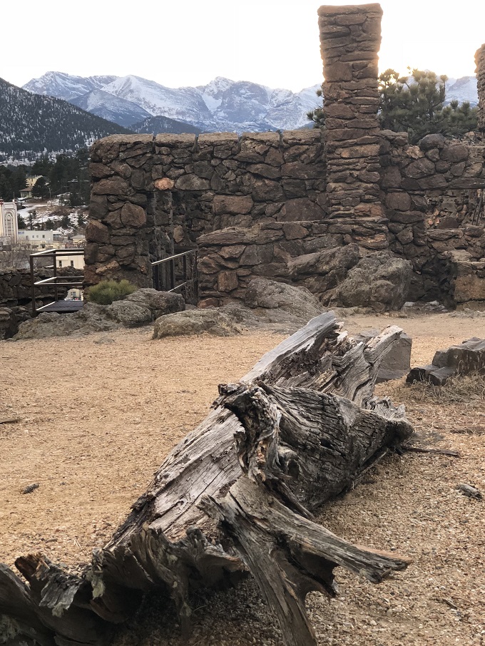
The Centennial Open Space at Knoll-Willows is located across the street from the historic Stanley Hotel. Someday, when I want to extend my excursion, I will walk around the hotel’s gift shop or warm up with a cup of butternut squash soup at their Cascades Restaurant & Lounge.
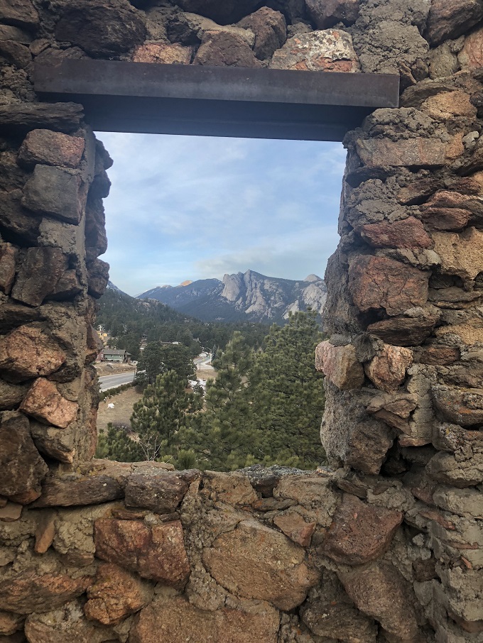
On this trip I was in a hurry and eager to capture the views over downtown Estes Park before sunset. I looped around the trail and stopped at several benches to take in the views of the mountains.
The open space is home to two historic structures. According to signage, these ruins used to be the home of Albert Birch, city editor for the Denver Post.
It was built with an impressive fireplace and large windows with enviable views of the Rocky Mountains.
I can imagine how cozy this home was back in 1907 when it was built.
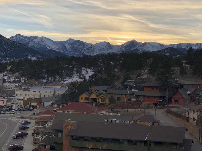
Overlooking downtown Estes Park, Colorado
From the hill where it rests, the quaint town of Estes Park glows under the setting sun. The trail can be followed down the hill towards Town Hall passing by another historic cabin.
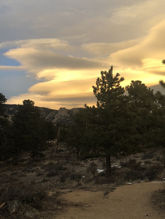
Rocky Mountain views
Although it was getting cold, I couldn’t stop watching the colorful sky and the snow capped mountains.
Twin Owls Sunset
Even though I loved spending some alone time here, I can’t wait to take my husband back for a romantic stroll or my girls back for a hike. The trail is short and easy enough for young kids to do on their own.
Winter Refresh
We have been doing a winter refresh project. Check out this post that we recently updated.
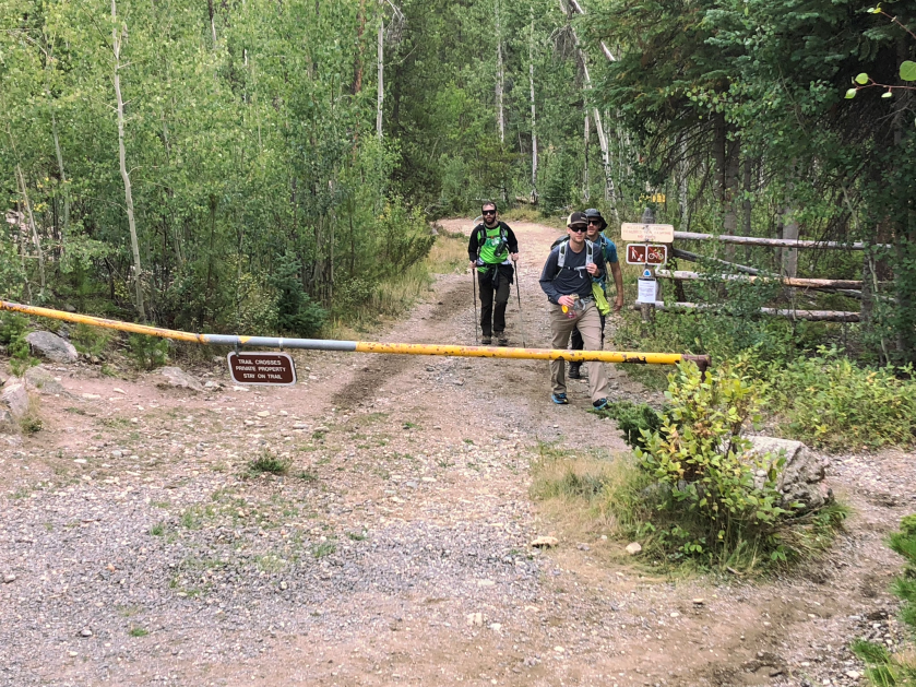
A Trip Report from Eric’s hike over the Continental Divide with friends on August 19, 2018
I’ve been visiting Rocky Mountain National Park with my family since I was a young child, and have always been simply drawn to the mountains and the adventure that awaits out in the alpine wilderness. Kelly and I have been consistently coming out to Estes Park together since 2012, and have been on a number of adventures of varying difficulties. Often after a long day of hiking, I’ll turn on the television to the local “Channel 8,” which features productions from Estes Park legend Nick Molle, as well as (of course) plenty of advertisements for the in-town businesses. One of Nick’s productions that still loops from time to time is a show called “A Walk in the Park,” which features some of the great hikes in Rocky, along with commentary from guide-book author and former park ranger Lisa Foster. Their special on Long’s Peak still captivates me as I re-live my first trip up that mountain with friends back in 2010, and recall how under-prepared I was for that journey! However, another hike that I had read about in Lisa’s guide book had been tugging at me as the next challenge I had to try—hiking from Bear Lake, the start of some of the most popular trails in the park, all the way over to Grand Lake on the other side of the park. When an episode of “A Walk in the Park” featured this journey, I was convinced that someday I needed to give it a shot.
We’ve been up Flattop Mountain and over to Hallett Peak numerous times, as its one of our favorite hikes (without carrying our children).
View near the summit of Flattop Mountain, from a prior trip
However, continuing the hike on to Grand Lake always seemed to be a bit of a stretch, both due to the distance, and just the logistics of arranging transportation back and forth over the mountain (at over 17 miles, it wasn’t a hike I wanted to turn around and repeat the next day). As we’ve had the truly immense joy of adding two beautiful young girls to our family in the past 4 years, some of these more difficult hikes had been shelved in favor of more kid friendly (or at least kid-carry friendly) destinations. Kelly is the best though, and after hearing me talk about this hike so much (probably to the point of driving her nuts), she finally told me that I needed to just plan the trip with some friends and make it happen. In August this year, we did just that.
A couple of general facts about this hike:
-Hike begins at the Bear Lake trailhead, which is extremely busy in the summer and fall months. Parking can be difficult to come by, but the early start required by this type of undertaking usually will guarantee a space.
-There are a few local shuttle services that will provide transportation back and forth from Grand Lake, but there are no park shuttles that go over Trail Ridge road, so individual arrangements must be made. We opted to drop a car off the night before over at the North Inlet trailhead (end of our hike) in Grand Lake. To leave a car overnight anywhere in the park, just make sure to get a free wilderness permit at one of the ranger stations (we obtained ours at the Kawaunechee Valley Visitors Center).
-As I’ll detail below, weather can be a wild card anytime you are heading above the tree-line, so a wide range of cold/wet weather gear is critical. Total elevation gain from Bear Lake to the summit of Flattop is roughly 2,850 feet, followed by a descent of roughly 3,800 feet to Grand Lake.
-Many people break this hike into a 2-day affair, camping at one of the numerous backcountry sites that are available on the second half of this trail, but we opted to travel more lightly and knock it all out in one day (which I honestly think is the easier approach given all of the elevation gain and decline involved).
-Though steep in a few places, this route is entirely a class 1 hike with no material amount of exposure to steep drop offs. Still, a poorly timed turned ankle 8-10 miles in would make for a rough day, so gear to survive overnight if needed is never a bad idea.
-We carried all of the water that we needed (roughly 3L per person) but there are plenty of places on the descent where a filter could be used to replenish supply.
On to the journey itself…
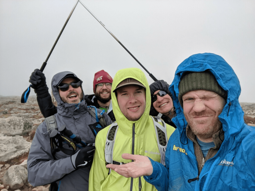
We set out for the trailhead at roughly 6:30am, hoping to get started shortly after 7:00. Everyone in our group had at least some high-elevation hiking experience, but you never know how altitude may impact aperson on any given day. After a bit of grumbling and the cynical remark “This is considered recreation, and fun, correct?” from one party member during the initial mile or so, everyone seemed to settle in to a comfortable pace.
Catching our breath early on the trail
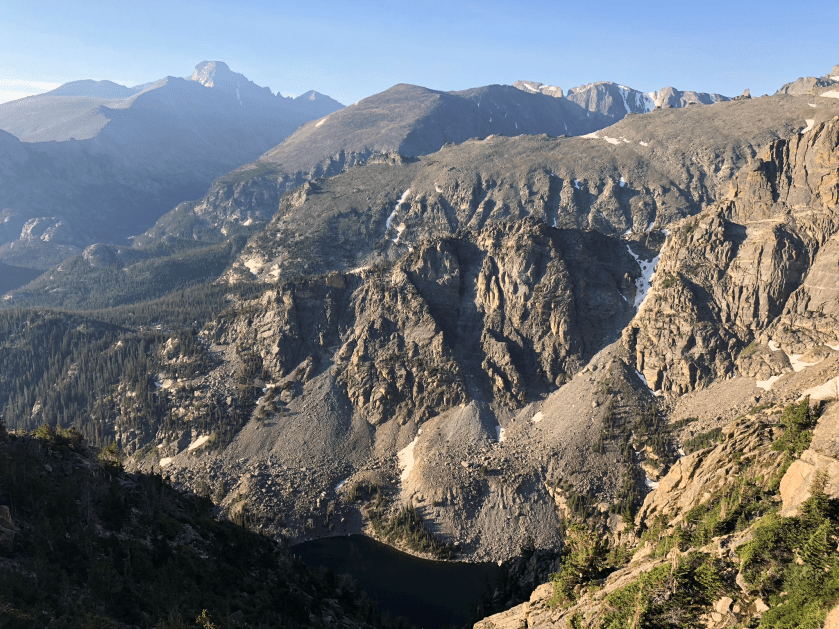
Three of our group of five had been on the first several miles of this hike up to Flattop multiple times, so for us there were plenty of familiar landmarks along the way, but most notably the Dream Lake overlook at approximately 1.7 miles, and then the Emerald Lake overlook at roughly 3.5 miles in.
Emerald Lake lookout, on a clear day
Unfortunately, we did not have the best of luck with weather for the early part of our trip, as we were hiking through a dense fog and some mist for the majority of our ascent. At approximately 4 miles in, we reached the hitch rack near the summit of Flattop, and took a more extended break with some snacks and plenty of water, knowing that the conditions were likely to be less than favorable for the next several miles up on the tundra. A little over two hours and twenty minutes into the hike, we reached the “summit” of Flattop mountain
Final approach to “summit” of FlattopClouds quickly rolled back in at the top
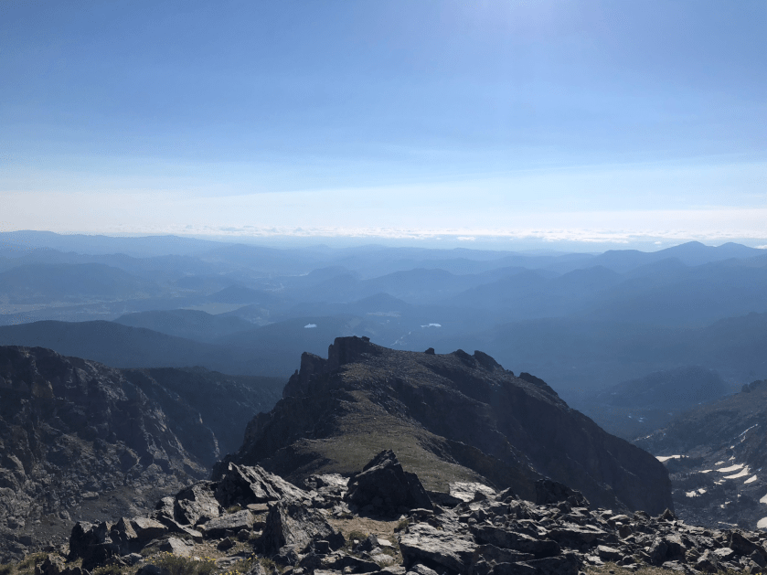
I always warn people that tell me they are heading up to Flattop, that as the name implies, the summit is very flat and thus the views are somewhat limited unless you make the extra .5 mile climb over to Hallett Peak. On this day, however, it would definitely not have been worth the extra work/scramble, as the fog was quite persistent. For comparison, here is a photo of the views that can be had from Hallett on a clear day—I took this picture just a few weeks before when I was training/researching the hike beyond the summit of Flattop.
Summit of Hallet on a clear day
From the summit of Flattop, we followed the clearly marked path to the North Inlet Trail Junction—which is identified with another sign and large cairn just a few tenths of a mile later.
While I was disappointed for the group that we did not get to experience what I had anticipated to be sweeping views of the horizon as we continued onward across the Tundra on the North Inlet Trail, it was mystical in its own way to follow the seemingly endless trail through the fog with cairns marking the way in the distance.
Into the abysss
We made relatively good time over this smooth terrain, as we were all a little chilly from the cold fog and mist. Thankfully there were no thunderstorms to contend with, as the time exposed dangerously above the tree line is significant during this portion of the trip. At roughly 6 miles / 3 hours into the hike, the terrain started to change slightly, as we got closer to the steeper descent down towards Grand Lake.
Terrain begins to shift
At approximately 6.8 miles, we crossed a stream and then began the section of the hike that I had been most anxious about: a mile of steep switchbacks.
Entering the switchbacks
I’d kept my trekking poles stowed thus far on the trip, but they were definitely a life-saver as we progressed through this somewhat more tedious but beautiful segment. Here we passed several other hikers carrying camping packs and heading in the other direction, which frankly looked brutal (all that weight and a quick 1000+ ft elevation gain).
Looking down the switchbacks, hikers approach from the other direction
At approximately 8 miles in, we crossed Hallett Creek, now fully back under the protection of the tree-line. While it was damp, our weather generally continued to hold, so we paused again for a bit longer of a break/re-fuel.
Hallett Creek
I’d been keeping an eye on the time and our pace with my Garmin GPS watch, and knowing that it was “all downhill from here” gave me some relief that we would be able to complete the trip and arrive in town well before the evening. The lack of elevation gain made it a lot easier for ourgroup (who had been largely quiet due to either lack of breath on the way up or chattering teeth walking across the tundra) to liven up and have the sort of silly debates/discussions that you undertake when you are together for 10+hours without much else to do. We almost missed this majestic bull elk along the trail as we plodded through the miles of well-groomed trail.
Elk in the meadow
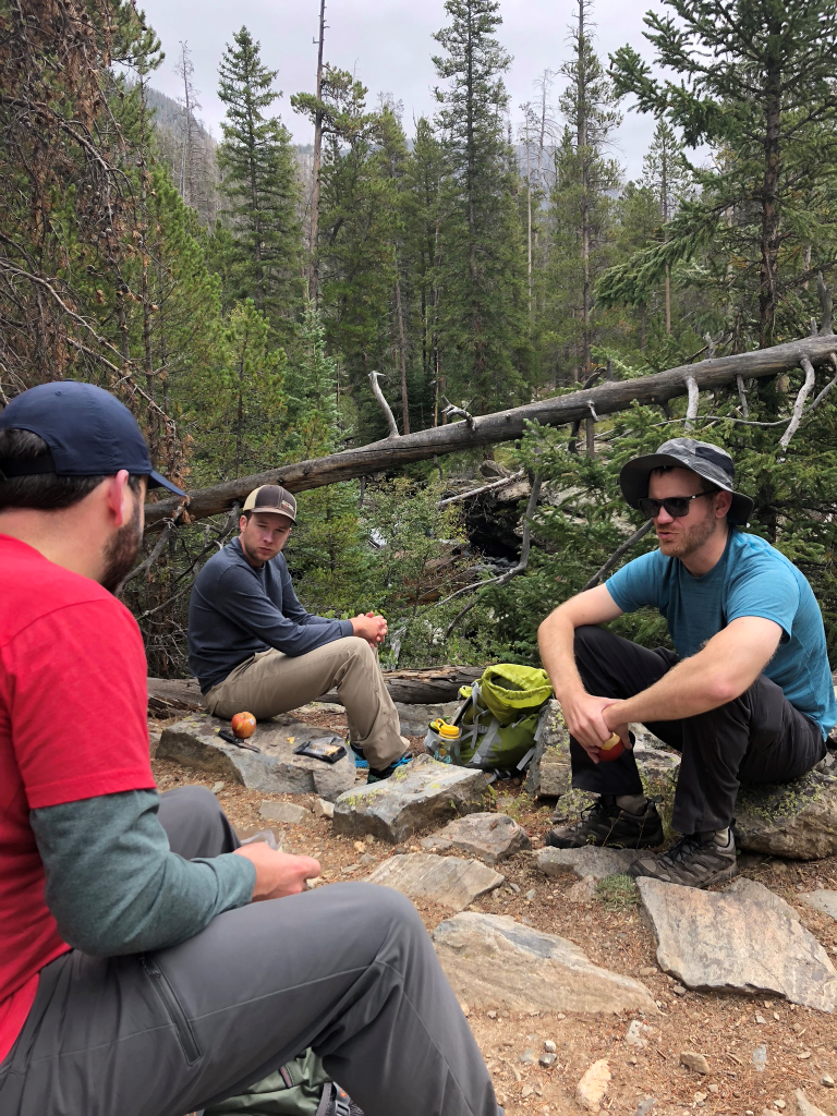
At around 6 hours/12 miles in, we stopped for our last extended break and got out “the good food” (apples, cheese, and summer sausage). At this point, all of us had tired legs but were generally in good spirits, even though we knew we still had another 5 or so miles to complete.
An extended break
As we slowly descended into the valley, we ran into more and more day hikers, or others coming in to camp for the night. It was a pleasant leg of the trip, with the river running next to or near to us for much of the time. We passed Cascade Falls, a place I’d like to revisit sometime when we have more time to linger. At this stage, everyone was impressed, but not terribly interested in further exploration/deviation from the trail. Finally, as we neared the end of our journey and began seeing signs of civilization, we started discussing the most important part of the trip: where we would find the best pizza and beer in Grand Lake to celebrate.
Meadows open up near the trail’s end
My GPS hit 17 miles, and I’d hoped that meant we were almost finished. Unfortunately, between a bit of wandering and perhaps some inaccuracy, it was off by about a mile.
False hope of the journey’s end
While that final mile was steady, easy terrain, it definitely felt like the most difficult of the trip, because even I was ready for this hike to be over. At last we emerged at the North Inlet trailhead, 8 hours and 28 minutes and (according to my watch) 18 miles later.
North Inlet Trailhead, Grand Lake
We all piled into my Explorer and headed into town for that long-desired pizza and beer at White Buffalo. While our journey was complete, I knew I had to keep my head on straight, as I had to drive us back over Trail Ridge road to pick up the rental car at Bear Lake, before we finally made it back to the condo for our full celebration. This was an epic trip for me and my friends. While it wasn’t nearly has harrowing as an exposed scramble on Long’s Peak, it was a great endurance challenge and incredible way to experience some of the more remote areas of the park (at least remote and trail accessible). If you are like me and incessantly research hikes like this before you undertake them, and have any questions that I didn’t address here, please don’t hesitate to comment below and I’ll do my best to answer them!
Tis the season for family road trips. If you are like many Midwestern families, you will be bundling up the kiddos and driving at least a couple of hours to visit loved ones this holiday season. How do you make this part of the holidays a little less stressful so you can focus on the festivities?
We’ve learned a lot from our frequent treks from our home town near Kansas City, MO to Estes Park, CO. This trip takes about 10.5 hours each way. One of the things we hear the most from friends with young kids is that they are intimidated to make long drives. We get it, driving all day is tough on us and really tough on the kiddos, but they usually do great.
Prepare for Traveling Day in Advance
The day before we go on our trip we make sure all of our electronics are charged, filled with downloaded content, and ready to go with car adapters. We recently bought the girls new Kid’s Kindle Fire tablets, but limit their use to road trips, so it feels like a special treat.
We also stock up on snacks and drinks for the road. While we often still end up buying odds and ends at gas stations (we try to buy something when we pop in for restroom breaks), its great to have a cooler full of milk for the girls and water/Gatorade for us. While it’s a tough balance to avoid too many extra bathroom breaks, we’ve found it to be important to stay fully hydrated on the trip out to fend off altitude sickness at our final destination. For us, it helps driving in to Colorado rather than flying in because our bodies can acclimate a little more gradually to the change. Altitude impacts everyone differently, even those in great physical condition, so we often advise family and friends who know that they struggle with the adjustment to stay near the Denver area for a night before going further up in the mountains.
Road Trip Backpacks with Activities
Each girl gets their own backpack filled with coloring, activity books and art supplies. We often listen to toddler radio stations to sing along to before switching to relaxing tunes around nap time.
Our Toddler Travel Bags Include:
Amazon Fire with a kid-proof (pink!) case – we are able to download their favorite videos, the girls can play games, and they love to take pictures with their tablets. We only let them use them on long road trips, so playing with the tablets feel like a big treat.
Tracing books to practice our preschooler’s emerging writing skills
Snacks, snacks and more snacks. You can’t have too many snacks
Water Wow! this is a mess free art activity that the girls can do again and again
Color Wonder Mess Free Coloring our girls love to draw and we love when we don’t have to worry about what they are coloring on because these markers only mark on the special color wonder paper.
Timing
We’ve tried several theories on the best way to time the long trip including leaving late and driving through the night or stopping half way and staying at a hotel. Surprisingly, we’ve found leaving mid-morning works best for our family. Here is our basic time-line:
7:00AM girls wake up, eat breakfast, play to burn off energy and we pack the car
9:00AM leave after making sure everyone has used the restroom and/or has fresh diaper
10:00AM we typically try to make it out-of-town before we start any electronics
12:00PM stop for lunch, bathroom and gas fill-up break
12:30PM get back in the car and hope for nap time
3:00PM stop for snack, bathroom and gas fill-up break
5:00PM we make a game time decision to stop for dinner or keep going
6:00-7:00PM estimated arrival. We gain an hour of sunlight when clocks change to Mountain Standard Time.
Route
Without traffic it’s just about as fast going through Denver and Boulder to get to Estes Park, but we typically take E-470 up by the airport to bypass most of the city. E-470 is a toll road and they will mail you a bill if you plan on going once, but if you plan on going to Colorado frequently, it might make sense to get an express toll pass.
Restroom Breaks
We bring along our own potty training toilet for the girls to use when we are in need of breaks between towns (which is common in the middle of Kansas and Eastern Colorado) or when we decide the toilets that are available are not clean enough to use.
Weather
We pay close attention to weather and road conditions using COtrip.org, KanDrive.org and our weather apps. In the spring and early summer we are concerned about pop up storms that can produce tornadoes. In the late fall through early spring we pay attention to icy roads and snow.
Whether you are going on a 1 hour trip or 10 hour trip, planning ahead, having lots of distractions including loads of snacks, and thinking through potential hiccups will help reduce the stress of traveling with young kids. We hope you enjoy happy and safe travels this holiday season.
We’d love to hear your opinion too. Do you have any road trip survival tips we missed?